


Land, the topmost part of the earth's surface, is seen everywhere.
Just as we have various means of determining the size, weight, angular distance, and other measurements of objects, the surface on which we walk on is no different thanks to land survey.
Land survey is a scientific and artistic means of determining existing or new measurements and sizes of land. It can be carried out to re-detect or detect existing corners, lines, and everything about discovering land measurement.
The survey has been around for several decades. For example, the famous Egyptian pyramid was created using land survey by an ancient surveyor.
Despite the absence of modern tools and equipment to achieve the size of land during ancient times, digits and figures were still accurate. However, the process was time-consuming and completely rigorous.
With the introduction of modern survey tools, it is easier to achieve land measurement with the best accuracy of figures. Furthermore, modern instruments for surveying land provide more precise figures, unlike the traditional method used in ancient times.
Land Surveying Equipment & their Uses
With the introduction and continuous adoption of modern equipment, we can now gradually bid farewell to traditional survey equipment such as dumpy level and compass. Below are the modern survey tools and equipment and their uses:
Global Positioning System (GPS)

Image credit: baselineequipment.com
The GPS is one of the foremost modern survey equipment anyone could think of. Global Positioning Systems, as fully known, have not only been adopted by surveyors worldwide but also branded into mobile phone applications, which helps reveal locations.
Arguably, GPS remains the most revolutionary modern tool that surveyors find easier to determine land position. This navigation system uses satellites, receiver algorithms for the synchronization of location, and other related things.
Uses of the Global Positioning System (GPS)
The uses include position determination, navigation from one point to the other, mapping, and a host of others. For GPS to be effective in land surveying, a surveyor must have a GPS receiver to locate a position on the ground.
When the receiver gets a signal from the satellite, it processes the signal and compute the positions. These positions include latitude and longitude.
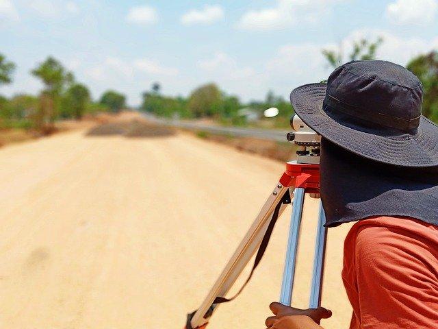
Total Station

Image credit: pobonline.com
Surveying can be a daunting task, especially if you have no staff on the field with you. As one of the modern survey equipment, a total station is a lightweight-designed tool for measuring angles.
Whether you’re on the field with staff or not, the station’s lightweight allows you to move with it from one point to another easily.
A total station is an optical surveying modern tool that uses electronics to calculate angles and distances. It is so reliable in surveying that it also combines the functions of other modern survey equipment (theodolite and electronic distance meter).
Uses of Total Station
The total station helps to read any slope distance from the instrument to any specific point. This optical surveying tool has a wide range of uses in survey activities. Some of its uses are:
- The total station helps to determine distances between a specific point on the ground and another
- Since it is an optical instrument that works by adopting electronic calculation, it helps to keep data safe
- Total station helps to display point details digitally
- It makes the measurement of angles easy
- This survey equipment helps process data collected from the survey field
The 3D Laser Scanning

Image credit: topographical.co.uk
You will probably be surprised to see 3D laser scanning technology adopted by surveyors. Don't worry, technology has gone far beyond just the photography or filming industry using 3D laser scanning to capture a high volume of images.
Just as the 3D process works in the photography sector, it also uses the same technology in surveying activities.
This process involves analyzing a real-world image or environment for the collection of information on its shape. The collected data then undergoes a process that you can use in the construction of digital 3D models.
The same process applies to survey as surveyors use this tech to capture 3D data while on site. 3D scanning in survey helps to capture and measure historical buildings or heritage sites.
Uses of 3D Laser Scanning
- Surveyors are often faced with complexity while measuring specific areas on the land. With 3D laser scanning, surveyors are provided with accurate results and measurements for areas with geometrical complications
- Laser 3D scanning extends to engineering survey as the main equipment for those dealing with infrastructural facilities. It is, however, the primary tech used for carrying out the accuracy of elevation surveys
- Laser 3D scanning helps surveyors get an accuracy of scans even at high speed. Also, surveyors get and check the data collected while on the survey field, which makes it easy to correct inaccurate reading before leaving the area
- When constructing dangerous highways, surveyors use lasers where traditional survey tools don’t fit in
Electronic Distance Measurement (EDM)

Image credit: civilsnapshot.com
Conventional means of surveying land include tape from a specific point to another point. With the introduction of modern survey equipment, EDM offers a wide range of applications beyond what the regular land measurement tools provide.
EDM also involves the measurement and determination of length between two points. However, something differentiates this measurement from the conventional one. EDM adopts electromagnetic waves to determine the length between two points.
It is one of the most reliable modern survey equipment due to its convenience and ability to measure long distances even up to a hundred kilometers. It relies on reception, propagation, and reflection of either light or radio waves to easily obtain directions and distances between two points.
EDM, as a modern survey tool, measures length with the use of amplitude-modulated infrared waves.
Uses of Electronic Distance Measurement (EDM)
- EDM helps to measure long distances easily
- It provides quick and accurate measurement
- It is used for a wide range of obstacles
- The equipment is used for placing objects or points in three dimensions relating to the unit
Automatic Level

Image credit: thetapestore.co.uk
Surveyors, engineers, or anyone who works in a construction site and understands why precision and accurate measurement are vital for delivering top-notch projects will need an auto-level.
This survey equipment, also called leveling lever, verifies or creates points in the same horizontal plane. It is a unique survey tool for leveling with an optical compensator for line of sight maintenance.
The tool is special because even if there is a slight shift while measuring the line of sight, it still provides precise and accurate results.
Uses of Automatic level
- Auto level in surveying is used to verify and establish points in the same horizontal plane
- It is used to measure differences in height and for setting heights
The Rotary Laser Level

Image credit: whartonhardware.com
Another equipment introduced by technology for easier survey exercise is the rotary laser level. This handy tool is used for the construction of indoor projects. It spins a beam of light quickly to create a complete 360-degree plane, either vertical or horizontal.
The rotary laser level is also fit for outdoor projects such as building up or sogging down with a laser receiver staff.
Uses of Rotary Laser Level
- With its ability to spin beams of light, it helps create a complete 360-degree plane
- Internally and externally, surveyors use the rotary laser level for fit-out projects
Digital Theodolite

Image credit: minesurveyor.net
Related to other modern survey equipment, Digital Theodolite is a survey instrument that helps to achieve precision while measuring both horizontal and vertical angles. It also helps surveyors determine the relative point positions on the ground.
Although there are two different types, it is best to use the digital variant for surveying activities. It offers an easy reading of measurements by providing digital readouts, ending the conventional direct reading from the traditional graduated circle.
It is made of a telescope placed on a base and used for the alignment of the target.
Uses of Digital Theodolite
- It helps to ascertain horizontal and vertical angles
Wrap Up
Precision and accuracy matter a lot in measurement and are equally important in land survey.
There are several available tools for surveys, although, not all of them offer the ease and efficiency the present world demands. The various modern survey equipment help to achieve these without wasting time while also making the work easier.
A quality-driven surveyor will find that these tools make surveying interesting, easy, and offer the best results in the shortest time possible.


1 comment
Durga shree N
Have good report
Leave a comment
This site is protected by hCaptcha and the hCaptcha Privacy Policy and Terms of Service apply.